Unveiling the Power of Geographic Information Systems (GIS)
In this article, we will delve into the world of GIS, exploring its key components, applications, and the transformative impact it has on decision-making processes.
Introduction:
In today's data-driven world, the effective management and analysis of spatial information have become increasingly vital across various industries. This is where Geographic Information Systems (GIS) come into play. It enables organizations and individuals to capture, store, manipulate, analyze, and present geographic data in a powerful and intuitive manner. In this article, we will delve into the world of it, exploring its key components, applications, and the transformative impact it has on decision-making processes.
Understanding Geographic Information Systems:
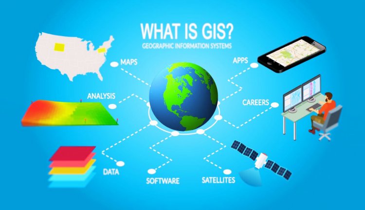
Geographic Information Systems (GIS) refer to a comprehensive set of tools and techniques designed to capture, store, analyze, manage, and present spatial data. At its core, it combines various elements such as software, hardware, data, and people to enable the effective visualization and analysis of geographically referenced information. it provides a platform for integrating multiple layers of data, including satellite imagery, aerial photography, topographic maps, and demographic information, creating a holistic understanding of the environment.

Key Components of GIS:
- Data: It relies on various types of data, including spatial and attribute data. Spatial data refers to information tied to specific geographic locations, while attribute data describes the characteristics associated with those locations. Integrating and analyzing these data types, it enables users to gain insights and make informed decisions.
- Software: Its software plays a crucial role in manipulating, analyzing, and visualizing spatial data. Some popular software options include ArcGIS, QGIS, and Google Earth. These tools provide a user-friendly interface and a wide range of functionalities to perform tasks such as data entry, geoprocessing, spatial analysis, and map creation.
- Hardware: The hardware component of it consists of the devices used to run its software, such as computers, tablets, smartphones, GPS devices, and remote sensing equipment. Advancements in technology have made it more accessible, portable, and integrated with other devices.
- People: It is not just about technology; it also involves individuals with expertise in geospatial analysis, data management, and cartography. Its professionals contribute to the effective utilization of its tools and the interpretation of spatial data to derive meaningful insights.
Applications of GIS:
- Urban Planning: It plays a crucial role in urban planning by assisting in land-use analysis, infrastructure development, transportation planning, and environmental impact assessment. It helps identify suitable locations for new construction projects, evaluate the impact of urbanization, and optimize resource allocation.
- Environmental Management: It aids in natural resource management, conservation efforts, and environmental impact assessment. It allows experts to monitor and analyze changes in land cover, biodiversity, water resources, and climate patterns, facilitating informed decision-making for sustainable development.
- Emergency Management: During emergencies or natural disasters, It helps in disaster response, mitigation, and recovery. It enables emergency planners to identify high-risk areas, allocate resources effectively, assess evacuation routes, and visualize real-time data to make informed decisions in critical situations.
- Public Health: It is extensively used in public health to track disease outbreaks, analyze patterns, and identify high-risk areas. It assists in epidemiological studies, resource allocation, healthcare planning, and the delivery of targeted interventions. It also aids in mapping healthcare facilities and optimizing their accessibility.
- Agriculture and Forestry: It enhances precision farming practices by providing farmers with valuable information about soil quality, vegetation patterns, and optimal crop management techniques. It also aids in forest management, including monitoring deforestation, mapping biodiversity hotspots, and managing wildlife habitats.
- Transportation and Logistics: It supports transportation planning, route optimization, and fleet management. It helps identify traffic congestion points, plan efficient public transportation networks, and optimize delivery routes for logistics companies, reducing costs and improving efficiency.
The Future of GIS:
It continues to evolve rapidly, with advancements in technology and the availability of vast amounts of spatial data. Some emerging trends include the integration of it with emerging technologies like artificial intelligence (AI), machine learning (ML), and the Internet of Things (IoT). This integration enhances spatial analysis, predictive modeling, and real-time data visualization capabilities.
Furthermore, the growing popularity of cloud-based its solutions enables organizations to access and share spatial data seamlessly, facilitating collaboration and improving decision-making processes. Mobile GIS applications are also becoming increasingly prevalent, allowing users to access and analyze spatial data on the go.
Conclusion:
Geographic Information Systems (GIS) have revolutionized the way we perceive, analyze, and manage spatial information. With its powerful analytical capabilities and diverse applications across various sectors, It has become an indispensable tool for decision-makers, researchers, and planners. As technology advances and spatial data continues to grow, it is poised to play an even more significant role in shaping our understanding of the world and enabling informed decision-making for a sustainable future.


